Body text
Among the biogenic volatile organic compounds (BVOCs), isoprene is by far the most important in terms of both global emission and atmospheric impact. As it is primarily emitted by terrestrial vegetation, with trees being the major contributors, its emission is critically dependent on land cover.
What is the impact of land cover changes on BVOCs emissions?
Satellite observations might help to answer that question and better account for human-driven land use practices (forest to crop or pasture conversion, logging and urbanization).
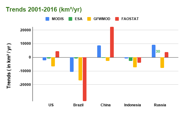
Three global satellite-based land cover datasets were used to evaluate this impact in recent years. Those datasets are based on MODIS, ESA CCI-LC and the MODIS dataset modified to match the tree cover distributions from the Global Forest Watch (GFWMOD) database. These remotely-sensed tree cover representations were also put in perspective with national estimates from the 2020 FAO forest database (FAOSTAT) based on national inventories.
Isoprene emission inventories relying on satellite-based land cover maps at annual time steps over 2001-2016 were generated using the state-of-the-art biogenic emission model MEGAN.
Our study showed that:
- great disparities were observed among the land cover datasets in terms of global areal coverage of trees (30-50 Mkm²) and their trends (from -0.26 to +0.03 %yr-1);
- the increasing trends in forest area reported by some national inventories (e.g., US and China) are not corroborated by the remotely-sensed datasets (Fig. 1);
- the global impact of land cover changes has a mitigating effect on the strong positive trends in isoprene emissions (0.94%yr-1) driven by meteorological parameters, primarily temperature and solar radiation;
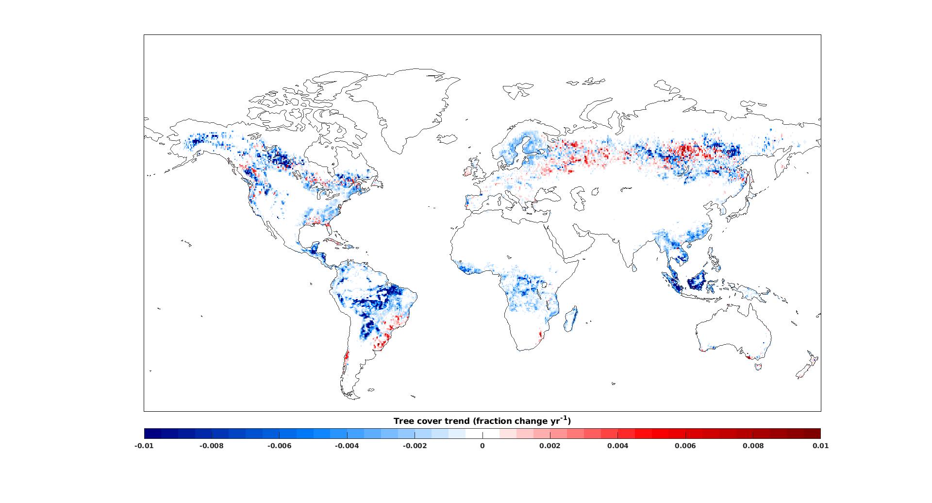
- the strongest cutbacks in global isoprene emission trends (0.33%yr-1) were obtained using the GFWMOD database due to the decreasing trends in tree cover (Fig. 2), in particular in the Tropics;
- the simulation using GFWMOD lead to a better agreement with spaceborne OMI HCHO trends over several forested regions.
Reference
Opacka, B., Müller, J.-F., Stavrakou, T., Bauwens, M., Sindelarova, K., Markova, J. and Guenther, A.B. Global and regional impacts of land cover changes on isoprene emissions derived from spaceborne data and the MEGAN model [manuscript submitted for publication].